La Grande Moucherolle, Vercors Plateau
Posted by Sam Harrison on October 22, 2013 at 12:23.
alps grenoble scrambling vercors
The weather forecast was pretty dismal for second weekend that I had in Grenoble, and so a weekend trip to bag another Alpine peaks was out of the question! Instead, I turned my attention to a smaller but equally as impressive peak in the immediate vicinity of Grenoble: La Grande Moucherolle.
The public transport around Grenoble and its suburbs is fantastic, with frequent bus services reaching the base of many good walks in the area. We had been given a ticket pre-loaded with ten TAG journeys on urban buses and trams, and when planning for the second weekend I was there, I was pleasantly surprised when I discovered that I could get as far as les Saillants-du-Gua (about an hour away by bus) using the ticket on the number 17 bus. There is also another "Flex" bus service from les Saillants to Prélenfrey, but this has to be booked in advance (and owing to the ever-changing weather forecast I hadn't got around to planning a route until the Friday evening - too late to book!). This left me with 1900m of ascent to the summit of my objective for the day - La Grande Moucherolle - and I decided this would be worth it to make the most of the free transport.
The forecast was pretty terrible, and the rain was meant to start around midday at the latest. Hence, I opted for an early start, and after catching the 7am bus from Trois Dauphins, I was walking by 8am. The first part of the route was nothing but a drag - for the sake of saving time and getting into the mountains as quickly as possible, I'd opted to walk along the road. A few hours and 600m of ascent later, I arrived in Prélenfrey, already feeling tired. Fortunately, my route then took me off-road and wound its way up through forest tracks to eventually reach the Barquette des Clos, a small shelter perched on the impressive Balcon Est. I was relying on there being a source of water at the shelter, as I had read previously, but upon reaching the so-called source I was dismayed to find it was completely dry. I decided to press on, but keep a careful eye on how much I was drinking. The rain that was forecast hadn't materialised either, and the sun had made an appearance, making the lack of water even more frustrating.

My route to la Grande Moucherolle was via the Col des Deux Soeurs, which is gained via a loose scree gully between the Deux Soeurs, with a few rocky steps of British grade I scrambling standard. There are vague signposts to the col, but they are not necessarily to be relied upon. From the Barquette des Clos, the best route is to follow the Balcon Est for a few kilometres until you are directly above a refuge at the top of the Col de l'Arzelier telesieges. Here, a good path branches off right and zigzags its way up the grassy slopes beneath the cliffs of the Deux Souers. Upon reaching the base of the cliffs, it traverses northwards back towards the col. A signpost marks the obvious start to the route up to the col. It isn't until you reach the base of these cliffs that you truly realise their scale, which is quite breathtaking and also intimidating, especially when traversing under then.
The gully to the col didn't pose too many difficulties, but was a little loose in places. I had a bite to eat once at the col, enjoying the unique limestone landscape that makes up the Vercors plateau, before taking a vague path that lead to the base of the eastern ridge up la Grande Moucherolle, a ridge which warrants an Alpine grade of F, and felt around I/II British scrambling grade. It is a little exposed in places, especially at the top, but there are quite a few options to limit the exposure. I couldn't see any need for a rope, unless your party is particularly inexperienced.

The summit commands an extensive view southwards across the Vercors plateau, and despite being very tired from the climbing and dehydrated from my lack of water, I decided the it was definitely the worth the ascent. It helped that I had the summit to myself, and I spent quite a while taking in the view. The time was now mid-afternoon and I was conscious that the last bus back of the day was at 7pm. With this is mind, I threw away my original plan of descending via the Pas de l'Oeille, and instead went back the same way as I ascended.


The descent dragged on and on, and by the time I reached les Saillants, I was tired and completely dehydrated. I hadn't paid too much attention to the actual distance of the route - as I previously mentioned, the planning was a bit last minute - and so I was very surprised that when I had a closer look at the map that it came to a shade under 30km. No wonder my legs were aching! I had a quick coffee in a cafe opposite the bus stop, before catching the 6pm bus back. Strangely, the weather had stayed dry all day, and did so until the minute I stepped back inside my apartment - perfect!
La Grande Moucherolle, Vercors Plateau
The public transport around Grenoble and its suburbs is fantastic, with frequent bus services reaching the base of many good walks in the area. We had been given a ticket pre-loaded with ten TAG journeys on urban buses and trams, and when planning for the second weekend I was there, I was pleasantly surprised when I discovered that I could get as far as les Saillants-du-Gua (about an hour away by bus) using the ticket on the number 17 bus. There is also another "Flex" bus service from les Saillants to Prélenfrey, but this has to be booked in advance (and owing to the ever-changing weather forecast I hadn't got around to planning a route until the Friday evening - too late to book!). This left me with 1900m of ascent to the summit of my objective for the day - La Grande Moucherolle - and I decided this would be worth it to make the most of the free transport.
The forecast was pretty terrible, and the rain was meant to start around midday at the latest. Hence, I opted for an early start, and after catching the 7am bus from Trois Dauphins, I was walking by 8am. The first part of the route was nothing but a drag - for the sake of saving time and getting into the mountains as quickly as possible, I'd opted to walk along the road. A few hours and 600m of ascent later, I arrived in Prélenfrey, already feeling tired. Fortunately, my route then took me off-road and wound its way up through forest tracks to eventually reach the Barquette des Clos, a small shelter perched on the impressive Balcon Est. I was relying on there being a source of water at the shelter, as I had read previously, but upon reaching the so-called source I was dismayed to find it was completely dry. I decided to press on, but keep a careful eye on how much I was drinking. The rain that was forecast hadn't materialised either, and the sun had made an appearance, making the lack of water even more frustrating.
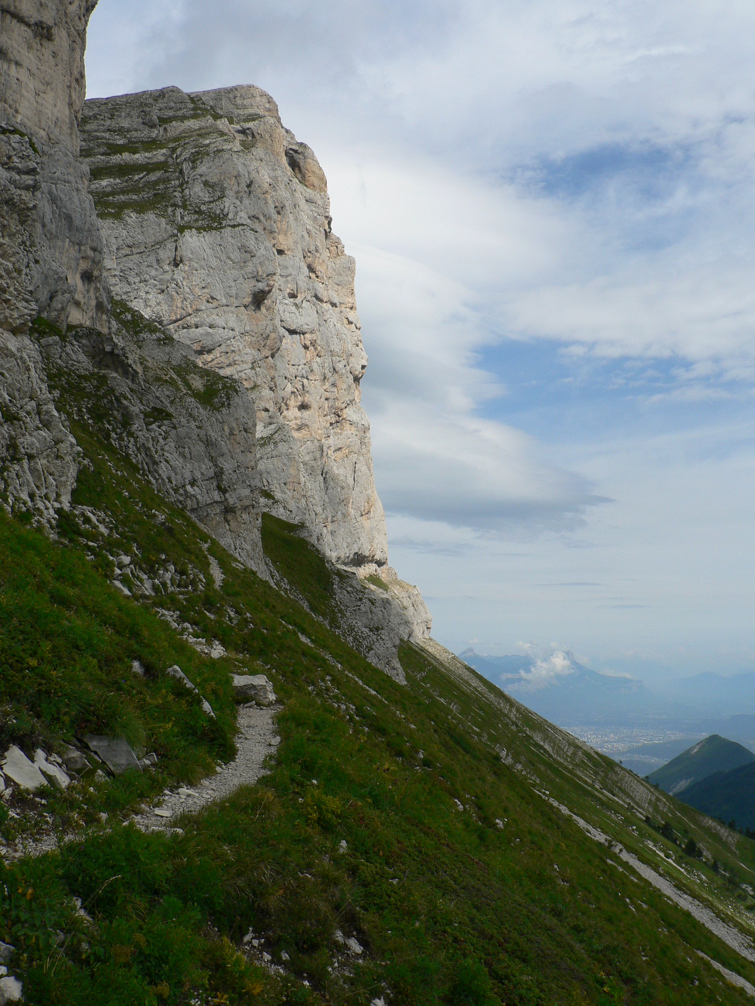
The beautiful Balcon Est path, looking southwards down the edge of the Vercors Plateau
My route to la Grande Moucherolle was via the Col des Deux Soeurs, which is gained via a loose scree gully between the Deux Soeurs, with a few rocky steps of British grade I scrambling standard. There are vague signposts to the col, but they are not necessarily to be relied upon. From the Barquette des Clos, the best route is to follow the Balcon Est for a few kilometres until you are directly above a refuge at the top of the Col de l'Arzelier telesieges. Here, a good path branches off right and zigzags its way up the grassy slopes beneath the cliffs of the Deux Souers. Upon reaching the base of the cliffs, it traverses northwards back towards the col. A signpost marks the obvious start to the route up to the col. It isn't until you reach the base of these cliffs that you truly realise their scale, which is quite breathtaking and also intimidating, especially when traversing under then.
Traversing under the Deux Soeurs
The gully to the col didn't pose too many difficulties, but was a little loose in places. I had a bite to eat once at the col, enjoying the unique limestone landscape that makes up the Vercors plateau, before taking a vague path that lead to the base of the eastern ridge up la Grande Moucherolle, a ridge which warrants an Alpine grade of F, and felt around I/II British scrambling grade. It is a little exposed in places, especially at the top, but there are quite a few options to limit the exposure. I couldn't see any need for a rope, unless your party is particularly inexperienced.
Looking back down the route to the col
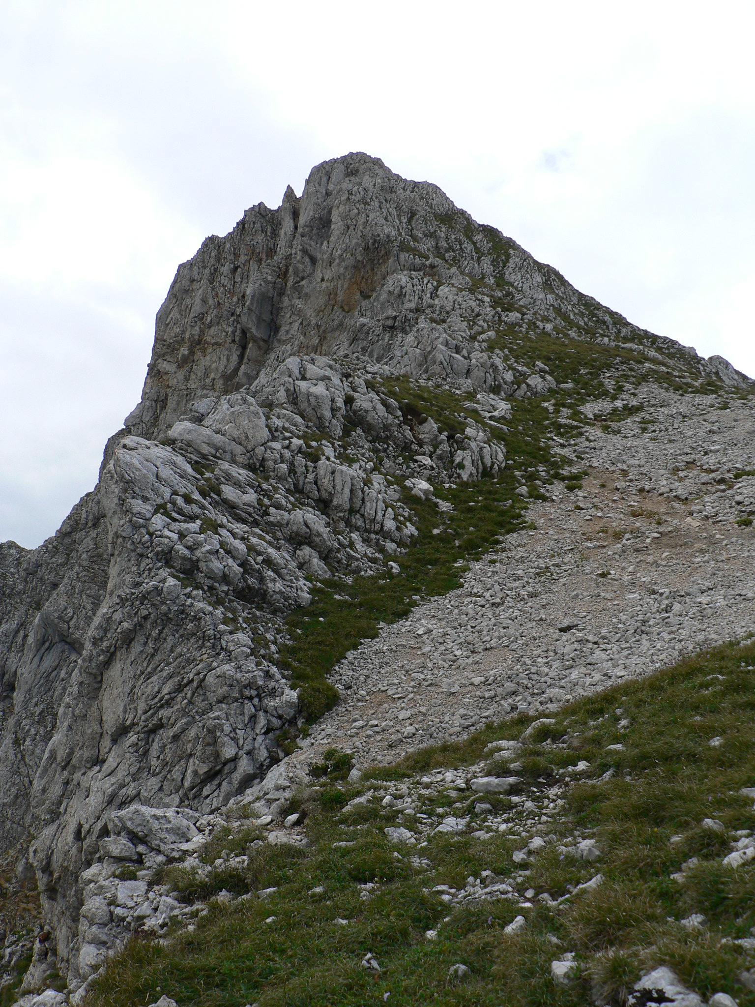
La Grande Moucherolle from the Col des Deux Soeurs
The eastern ridge of la Grande Moucherolle
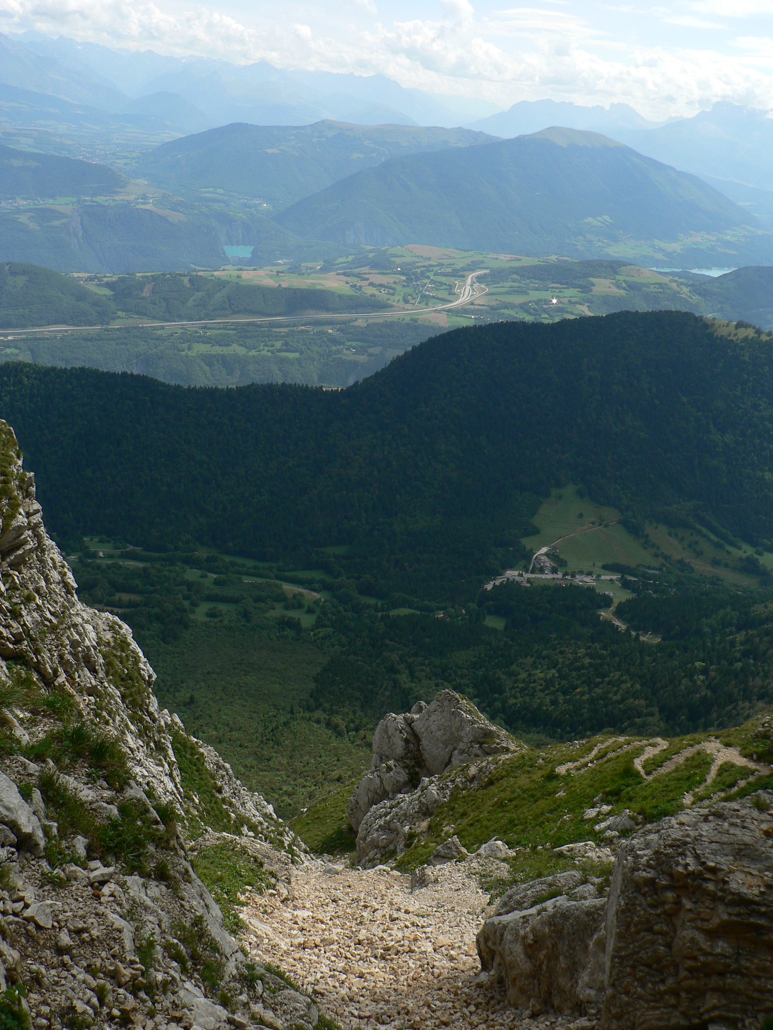
The summit commands an extensive view southwards across the Vercors plateau, and despite being very tired from the climbing and dehydrated from my lack of water, I decided the it was definitely the worth the ascent. It helped that I had the summit to myself, and I spent quite a while taking in the view. The time was now mid-afternoon and I was conscious that the last bus back of the day was at 7pm. With this is mind, I threw away my original plan of descending via the Pas de l'Oeille, and instead went back the same way as I ascended.
The summit
Looking southwards down the edge of the Vercors Plateau
The descent dragged on and on, and by the time I reached les Saillants, I was tired and completely dehydrated. I hadn't paid too much attention to the actual distance of the route - as I previously mentioned, the planning was a bit last minute - and so I was very surprised that when I had a closer look at the map that it came to a shade under 30km. No wonder my legs were aching! I had a quick coffee in a cafe opposite the bus stop, before catching the 6pm bus back. Strangely, the weather had stayed dry all day, and did so until the minute I stepped back inside my apartment - perfect!